
East Cape topographic map
Interactive map
Click on the map to display elevation.
About this map
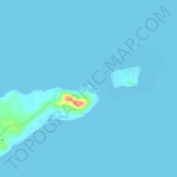
Name: East Cape topographic map, elevation, terrain.
Location: East Cape, Milne Bay, Southern Region, Papua New Guinea (-10.24582 150.85391 -10.20582 150.89391)
Average elevation: 2 m
Minimum elevation: 0 m
Maximum elevation: 89 m
Other topographic maps
Click on a map to view its topography, its elevation and its terrain.
Woodlark Island
Woodlark Island, Losuia District, Milne Bay, Papua Region, Papua New Guinea
Average elevation: 9 m
Normanby Island
Normanby Island, Esa’ala District, Milne Bay, Papua Region, Papua New Guinea
Average elevation: 49 m
Goodenough Island
Goodenough Island, Esa’ala District, Milne Bay, Papua Region, Papua New Guinea
Average elevation: 103 m
Fergusson Island
Fergusson Island, Esa’ala District, Milne Bay, Papua Region, Papua New Guinea
Average elevation: 98 m