
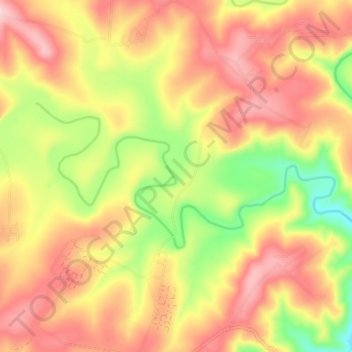
Nqamakwe River topographic map
Interactive map
Click on the map to display elevation.
About this map
Name: Nqamakwe River topographic map, elevation, terrain.
Average elevation: 763 m
Minimum elevation: 639 m
Maximum elevation: 858 m
Other topographic maps
Click on a map to view its topography, its elevation and its terrain.
Zizamele
South Africa > Eastern Cape > Amathole District Municipality > Mnquma Local Municipality
Average elevation: 613 m
eMazizini
South Africa > Eastern Cape > Amathole District Municipality > Mnquma Local Municipality
Average elevation: 585 m
Luxeni
South Africa > Eastern Cape > Amathole District Municipality > Mnquma Local Municipality
Average elevation: 553 m
Ngqamakhwe
South Africa > Eastern Cape > Amathole District Municipality > Mnquma Local Municipality
Average elevation: 998 m
Butterworth
South Africa > Eastern Cape > Amathole District Municipality > Mnquma Local Municipality
Average elevation: 599 m