
Heidelberg topographic map
Interactive map
Click on the map to display elevation.
About this map
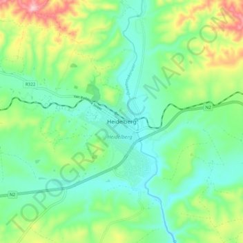
Name: Heidelberg topographic map, elevation, terrain.
Location: Heidelberg, George, Western Cape, 6665, South Africa (-34.12996 20.91859 -34.04996 20.99859)
Average elevation: 146 m
Minimum elevation: 59 m
Maximum elevation: 354 m
Other topographic maps
Click on a map to view its topography, its elevation and its terrain.