
Campoalegre topographic map
Interactive map
Click on the map to display elevation.
About this map
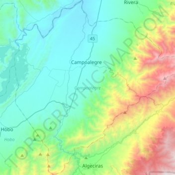
Name: Campoalegre topographic map, elevation, terrain.
Location: Campoalegre, Huila, Colombia (2.51027 -75.43892 2.78109 -75.17014)
Average elevation: 1,072 m
Minimum elevation: 458 m
Maximum elevation: 3,076 m