
Goirle topographic map
Interactive map
Click on the map to display elevation.
About this map
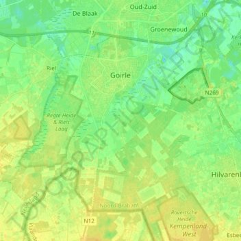
Name: Goirle topographic map, elevation, terrain.
Location: Goirle, Brabant-Septentrional, Pays-Bas (51.47111 4.96257 51.54013 5.11065)
Average elevation: 18 m
Minimum elevation: 8 m
Maximum elevation: 26 m