
Thank you for supporting this site ❤️
Make a donation
Make a donation
Chatsworth topographic map
Click on the map to display elevation.
Thank you for supporting this site ❤️
Make a donation
Make a donation
About this map
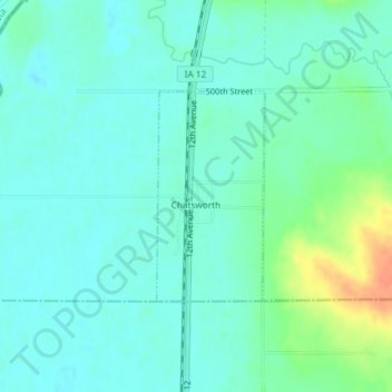
Name: Chatsworth topographic map, elevation, terrain.
Location: Chatsworth, Sioux County, Iowa, 51011, United States (42.90899 -96.51964 42.92352 -96.50944)
Average elevation: 357 m
Minimum elevation: 346 m
Maximum elevation: 389 m
Thank you for supporting this site ❤️
Make a donation
Make a donation