
Thank you for supporting this site ❤️
Make a donation
Make a donation
Greylingstad topographic map
Click on the map to display elevation.
Thank you for supporting this site ❤️
Make a donation
Make a donation
About this map
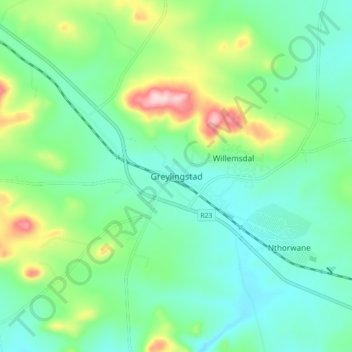
Name: Greylingstad topographic map, elevation, terrain.
Average elevation: 1,635 m
Minimum elevation: 1,563 m
Maximum elevation: 1,832 m
Thank you for supporting this site ❤️
Make a donation
Make a donation
Other topographic maps
Click on a map to view its topography, its elevation and its terrain.
Dipaleseng Local Municipality
South Africa > Mpumalanga > Gert Sibande > Dipaleseng Local Municipality
Average elevation: 1,574 m