
Vechta topographic map
Interactive map
Click on the map to display elevation.
About this map
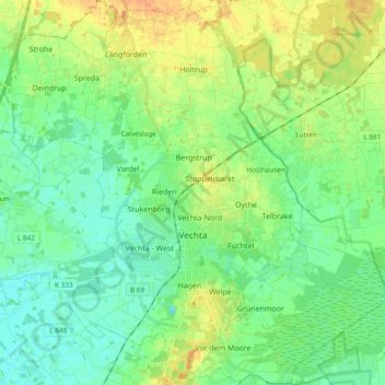
Name: Vechta topographic map, elevation, terrain.
Location: Vechta, Landkreis Vechta, Baja Sajonia, 49377, Alemania (52.68681 8.19468 52.80058 8.38397)
Average elevation: 39 m
Minimum elevation: 27 m
Maximum elevation: 60 m