
Johannesberg topographic map
Interactive map
Click on the map to display elevation.
About this map
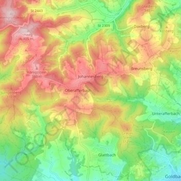
Name: Johannesberg topographic map, elevation, terrain.
Location: Johannesberg, Landkreis Aschaffenburg, Bavaria, 63867, Germany (50.00593 9.09105 50.04611 9.17933)
Average elevation: 267 m
Minimum elevation: 142 m
Maximum elevation: 403 m