
Namakwa topographic map
Interactive map
Click on the map to display elevation.
About this map
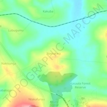
Name: Namakwa topographic map, elevation, terrain.
Location: Namakwa, Mukono, Central Region, Uganda (0.26964 32.78526 0.30964 32.82526)
Average elevation: 1,169 m
Minimum elevation: 1,127 m
Maximum elevation: 1,252 m
Other topographic maps
Click on a map to view its topography, its elevation and its terrain.