
Zamora topographic map
Interactive map
Click on the map to display elevation.
About this map
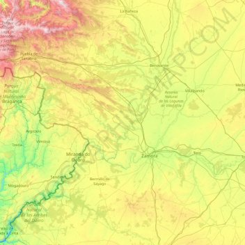
Name: Zamora topographic map, elevation, terrain.
Location: Zamora, Castile and León, Spain (41.11717 -7.03404 42.25418 -5.22887)
Average elevation: 803 m
Minimum elevation: 192 m
Maximum elevation: 2,162 m
Other topographic maps
Click on a map to view its topography, its elevation and its terrain.