
Lewis Glacier topographic map
Interactive map
Click on the map to display elevation.
About this map
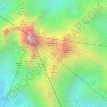
Name: Lewis Glacier topographic map, elevation, terrain.
Location: Lewis Glacier, Embu County, East Kenya, Kenya (-0.15853 37.31244 -0.15439 37.31658)
Average elevation: 4,581 m
Minimum elevation: 4,191 m
Maximum elevation: 5,149 m
Other topographic maps
Click on a map to view its topography, its elevation and its terrain.