
San Javier topographic map
Interactive map
Click on the map to display elevation.
About this map
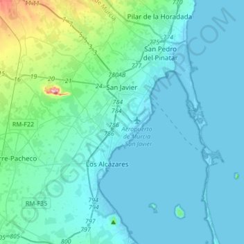
Name: San Javier topographic map, elevation, terrain.
Location: San Javier, Campo de Cartagena, Murcia, Spain (37.66826 -0.91184 37.88156 -0.69768)
Average elevation: 29 m
Minimum elevation: -5 m
Maximum elevation: 270 m