

Ukraine topographic maps
Click on a map to view its topography, its elevation and its terrain.









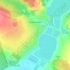


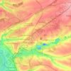


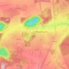


Perepilkyne
Ukraine > Autonomous Republic of Crimea > Dzhankoy Raion > Заречненское сельское поселение
Average elevation: 10 m
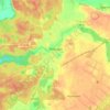


Putilovka
Ukraine > Autonomous Republic of Crimea > Bakhchysarai Raion > Голубинское сельское поселение
Average elevation: 344 m

Dnipro
Ukraine > Dnipropetrovsk Oblast
Under the Köppen–Geiger climate classification system, Dnipro has a humid continental climate (Dfa/Dfb). Snowfall is more common in the hills than at the city's lower elevations. The city has four distinct seasons: a cold, snowy winter; a hot summer; and two relatively wet transition periods. However,…
Average elevation: 90 m


About this place
Donetsk Oblast • Lviv Oblast • Kyiv Oblast • Kharkiv Oblast • Ivano-Frankivsk Oblast • Dnipropetrovsk Oblast • Zaporizhia Oblast • Luhansk Oblast • Odesa Oblast • Sumy Oblast • Zakarpattia Oblast • Poltava Oblast • Zhytomyr Oblast • Cherkasy Oblast • Rivne Oblast • Khmelnytskyi Oblast • Vinnytsia Oblast • Kherson Oblast • Autonomous Republic of Crimea • Kirovohrad Oblast • Volyn Oblast • Ternopil Oblast • Chernihiv Oblast • Mykolaiv Oblast • Chernivtsi Oblast • Kyiv • Republic of Crimea • Sevastopol • Simferopol District • Chornomorske Raion • Ермаковское сельское поселение • Dzhankoy Raion • Пятихатское сельское поселение • Sudova Vyshnia • Tiaziv