
Thank you for supporting this site ❤️
Make a donation
Make a donation
Enderby topographic map
Click on the map to display elevation.
Thank you for supporting this site ❤️
Make a donation
Make a donation
Enderby
Latitude-Longitude: 50°33′03.0″N 119°08′22.7″W / 50.550833°N 119.139639°W / 50.550833; -119.139639 elevation: 360 metres
Thank you for supporting this site ❤️
Make a donation
Make a donation
About this map
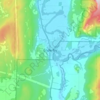
Name: Enderby topographic map, elevation, terrain.
Average elevation: 511 m
Minimum elevation: 347 m
Maximum elevation: 1,164 m
Thank you for supporting this site ❤️
Make a donation
Make a donation