
Villigen topographic map
Interactive map
Click on the map to display elevation.
About this map
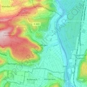
Name: Villigen topographic map, elevation, terrain.
Location: Villigen, Bezirk Brugg, Argovie, Suisse (47.50714 8.16632 47.54705 8.23461)
Average elevation: 427 m
Minimum elevation: 320 m
Maximum elevation: 676 m
Other topographic maps
Click on a map to view its topography, its elevation and its terrain.
Mandach
Suisse > Argovie > Bezirk Brugg > Mandach
Mandach, Bezirk Brugg, Argovie, 5318, Suisse
Average elevation: 517 m