
Malvern Hills topographic map
Interactive map
Click on the map to display elevation.
About this map
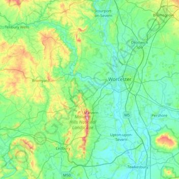
Name: Malvern Hills topographic map, elevation, terrain.
Location: Malvern Hills, Worcestershire, England, United Kingdom (51.96656 -2.66321 52.36851 -2.14875)
Average elevation: 82 m
Minimum elevation: 7 m
Maximum elevation: 423 m
Other topographic maps
Click on a map to view its topography, its elevation and its terrain.
Malvern
United Kingdom > England > Worcestershire > Malvern Hills
Malvern, Malvern Hills, Worcestershire, England, WR14 2HX, United Kingdom
Average elevation: 95 m