
District # 3 topographic map
Interactive map
Click on the map to display elevation.
About this map
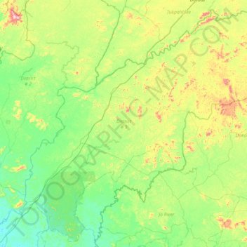
Name: District # 3 topographic map, elevation, terrain.
Location: District # 3, Grand Bassa County, Liberia (5.95576 -9.87313 6.63454 -9.15832)
Average elevation: 172 m
Minimum elevation: 28 m
Maximum elevation: 593 m
Other topographic maps
Click on a map to view its topography, its elevation and its terrain.
Commonwealth-B
Commonwealth-B, Grand Bassa County, 4000, Liberia
Average elevation: 4 m