
Malgasrivier topographic map
Click on the map to display elevation.
About this map
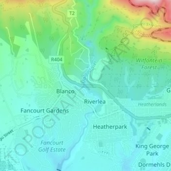
Name: Malgasrivier topographic map, elevation, terrain.
Average elevation: 284 m
Minimum elevation: 187 m
Maximum elevation: 681 m
Other topographic maps
Click on a map to view its topography, its elevation and its terrain.
Tsitsikamma National Park (Marine Reserve)
South Africa > Western Cape > George
Average elevation: 50 m