
Haarlem topographic map
Click on the map to display elevation.
About this map
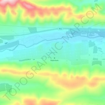
Name: Haarlem topographic map, elevation, terrain.
Location: Haarlem, George, Western Cape, South Africa (-33.75389 23.31861 -33.71389 23.35861)
Average elevation: 874 m
Minimum elevation: 752 m
Maximum elevation: 1,111 m
Other topographic maps
Click on a map to view its topography, its elevation and its terrain.