
Yongsan-ri topographic map
Interactive map
Click on the map to display elevation.
About this map
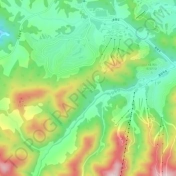
Name: Yongsan-ri topographic map, elevation, terrain.
Average elevation: 851 m
Minimum elevation: 692 m
Maximum elevation: 1,106 m
Other topographic maps
Click on a map to view its topography, its elevation and its terrain.
발왕산
South Korea > Pyeongchang-gun > Daegwannyeong-myeon
발왕산, Daegwannyeong-myeon, Pyeongchang-gun, Gangwon, 25352, South Korea
Average elevation: 1,137 m