
Gauja topographic map
Interactive map
Click on the map to display elevation.
About this map
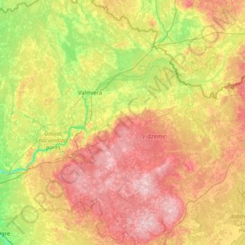
Name: Gauja topographic map, elevation, terrain.
Location: Gauja, Vecpiebalgas novads, Vidzeme, LV-4125, Latvia (57.06677 24.26505 57.70536 26.57436)
Average elevation: 102 m
Minimum elevation: 9 m
Maximum elevation: 286 m
Other topographic maps
Click on a map to view its topography, its elevation and its terrain.
Gauja National Park
Gauja National Park, Slikts ceļš, Edernieki, Pārgaujas novads, Vidzeme, LV-4146, Latvia
Average elevation: 93 m