
Ahrensfelde topographic map
Interactive map
Click on the map to display elevation.
About this map
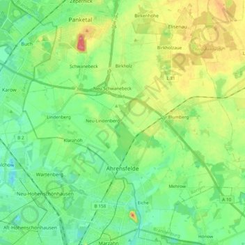
Name: Ahrensfelde topographic map, elevation, terrain.
Location: Ahrensfelde, Barnim, Brandenburg, 16356, Deutschland (52.54557 13.49666 52.65433 13.68596)
Average elevation: 67 m
Minimum elevation: 42 m
Maximum elevation: 115 m
Other topographic maps
Click on a map to view its topography, its elevation and its terrain.
Blumberg
Deutschland > Brandenburg > Ahrensfelde > Blumberg
Blumberg, Ahrensfelde, Barnim, Brandenburg, Deutschland
Average elevation: 75 m