
Donghae-myeon topographic map
Interactive map
Click on the map to display elevation.
About this map
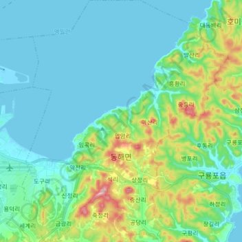
Name: Donghae-myeon topographic map, elevation, terrain.
Average elevation: 50 m
Minimum elevation: -2 m
Maximum elevation: 239 m
Other topographic maps
Click on a map to view its topography, its elevation and its terrain.
Buk-gu
Buk-gu, Pohang-si, North Gyeongsang, South Korea
Average elevation: 132 m
Cheongnim-dong
South Korea > Pohang-si > Cheongnim-dong
Cheongnim-dong, Nam-gu, Pohang-si, Gyeongsangbuk-do, South Korea
Average elevation: 11 m
Ocheon-eup
South Korea > Pohang-si > Ocheon-eup
Ocheon-eup, Nam-gu, Pohang-si, Gyeongsangbuk-do, South Korea
Average elevation: 166 m