
Thank you for supporting this site ❤️
Make a donation
Make a donation
Lørenskog topographic map
Click on the map to display elevation.
Thank you for supporting this site ❤️
Make a donation
Make a donation
About this map
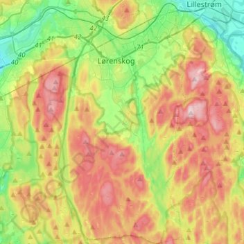
Name: Lørenskog topographic map, elevation, terrain.
Location: Lørenskog, Viken, Norway (59.83638 10.90716 59.95796 11.03063)
Average elevation: 223 m
Minimum elevation: 91 m
Maximum elevation: 392 m
Thank you for supporting this site ❤️
Make a donation
Make a donation
Other topographic maps
Click on a map to view its topography, its elevation and its terrain.