
Thank you for supporting this site ❤️
Make a donation
Make a donation
Arrabal topographic map
Click on the map to display elevation.
Thank you for supporting this site ❤️
Make a donation
Make a donation
About this map
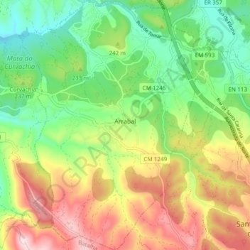
Name: Arrabal topographic map, elevation, terrain.
Location: Arrabal, Leiria, Portugal (39.67008 -8.75990 39.72756 -8.70416)
Average elevation: 223 m
Minimum elevation: 78 m
Maximum elevation: 433 m
Thank you for supporting this site ❤️
Make a donation
Make a donation
Other topographic maps
Click on a map to view its topography, its elevation and its terrain.