
Thank you for supporting this site ❤️
Make a donation
Make a donation
Arneiro topographic map
Click on the map to display elevation.
Thank you for supporting this site ❤️
Make a donation
Make a donation
About this map
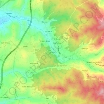
Name: Arneiro topographic map, elevation, terrain.
Location: Arneiro, Colmeias e Memória, Leiria, 2420-205, Portugal (39.77478 -8.73188 39.81478 -8.69188)
Average elevation: 171 m
Minimum elevation: 84 m
Maximum elevation: 270 m
Thank you for supporting this site ❤️
Make a donation
Make a donation
Other topographic maps
Click on a map to view its topography, its elevation and its terrain.
Thank you for supporting this site ❤️
Make a donation
Make a donation