
Cessange topographic map
Interactive map
Click on the map to display elevation.
About this map
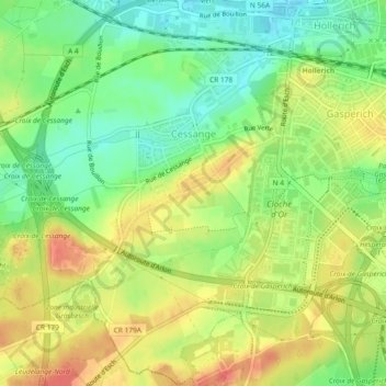
Name: Cessange topographic map, elevation, terrain.
Location: Cessange, Luxembourg, Canton Luxembourg, Luxembourg (49.57119 6.07298 49.60029 6.11649)
Average elevation: 291 m
Minimum elevation: 263 m
Maximum elevation: 321 m
Other topographic maps
Click on a map to view its topography, its elevation and its terrain.
Ville-Haute
Ville-Haute, Luxembourg, Canton Luxembourg, Luxembourg
Average elevation: 295 m
Clausen
Clausen, Luxembourg, Canton Luxembourg, Luxembourg
Average elevation: 300 m
Château de Septfontaines
Château de Septfontaines, Rue de Rollingergrund, Rollingergrund, Luxembourg, Canton Luxembourg, 2621, Luxembourg
Average elevation: 316 m