
Thank you for supporting this site ❤️
Make a donation
Make a donation
Jiri topographic map
Click on the map to display elevation.
Thank you for supporting this site ❤️
Make a donation
Make a donation
About this map
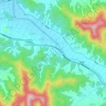
Name: Jiri topographic map, elevation, terrain.
Location: Jiri, Gokseong-gun, South Jeolla, 57516, South Korea (35.23457 127.14293 35.27457 127.18293)
Average elevation: 171 m
Minimum elevation: 81 m
Maximum elevation: 406 m
Thank you for supporting this site ❤️
Make a donation
Make a donation