
Le Cornate topographic map
Interactive map
Click on the map to display elevation.
About this map
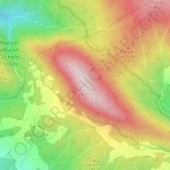
Name: Le Cornate topographic map, elevation, terrain.
Location: Le Cornate, Montieri, Grosseto, Toscane, Italie (43.15757 10.95518 43.15767 10.95528)
Average elevation: 783 m
Minimum elevation: 486 m
Maximum elevation: 1,045 m
Other topographic maps
Click on a map to view its topography, its elevation and its terrain.