
Montieri topographic map
Interactive map
Click on the map to display elevation.
About this map
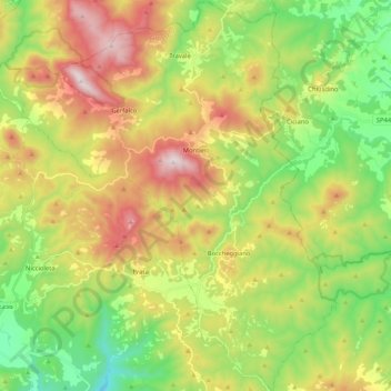
Name: Montieri topographic map, elevation, terrain.
Location: Montieri, Grosseto, Toscane, Italie (43.03679 10.90867 43.18914 11.09145)
Average elevation: 516 m
Minimum elevation: 145 m
Maximum elevation: 1,047 m
Other topographic maps
Click on a map to view its topography, its elevation and its terrain.
Le Cornate
Le Cornate, Montieri, Grosseto, Toscane, Italie
Average elevation: 783 m