
Paranhos topographic map
Interactive map
Click on the map to display elevation.
About this map
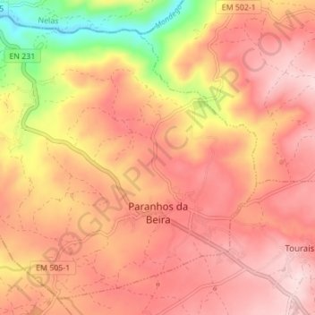
Name: Paranhos topographic map, elevation, terrain.
Location: Paranhos, Seia, Guarda, Portugal (40.46280 -7.82894 40.50991 -7.76015)
Average elevation: 374 m
Minimum elevation: 178 m
Maximum elevation: 478 m
Other topographic maps
Click on a map to view its topography, its elevation and its terrain.
Travancinha
Travancinha, Seia, Guarda, 6270-605, Portugal
Average elevation: 386 m
Sazes da Beira
Sazes da Beira, Seia, Guarda, Portugal
Average elevation: 766 m
Carragozela
Carragozela, Seia, Guarda, 6270-584, Portugal
Average elevation: 474 m
Serra da Estrela
Serra da Estrela, Seia, Guarda, Portugal
Average elevation: 1,825 m