
Thank you for supporting this site ❤️
Make a donation
Make a donation
Elbrinxen topographic map
Click on the map to display elevation.
Thank you for supporting this site ❤️
Make a donation
Make a donation
About this map
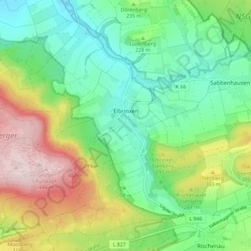
Name: Elbrinxen topographic map, elevation, terrain.
Location: Elbrinxen, Lügde, Kreis Lippe, Noordrijn-Westfalen, Duitsland (51.88797 9.19635 51.92058 9.27957)
Average elevation: 232 m
Minimum elevation: 115 m
Maximum elevation: 452 m
Thank you for supporting this site ❤️
Make a donation
Make a donation
Other topographic maps
Click on a map to view its topography, its elevation and its terrain.