
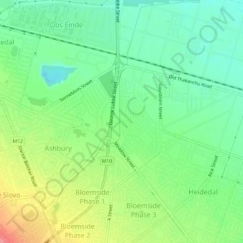
Mangaung Ward 47 topographic map
Interactive map
Click on the map to display elevation.
About this map
Name: Mangaung Ward 47 topographic map, elevation, terrain.
Average elevation: 1,378 m
Minimum elevation: 1,347 m
Maximum elevation: 1,432 m
Other topographic maps
Click on a map to view its topography, its elevation and its terrain.
Bloemfontein
South Africa > Free State > Mangaung Metropolitan Municipality
Bloemfontein, Mangaung Metropolitan Municipality, Free State, 9300, South Africa
Average elevation: 1,374 m
Thaba Nchu 1
South Africa > Free State > Mangaung Metropolitan Municipality
Thaba Nchu 1, Mangaung Metropolitan Municipality, Free State, 9780, South Africa
Average elevation: 1,527 m
Houtnek
South Africa > Free State > Mangaung Metropolitan Municipality
Houtnek, Mangaung Ward 41, Mangaung Metropolitan Municipality, Free State, South Africa
Average elevation: 1,508 m
Bloemspruit
South Africa > Free State > Mangaung Metropolitan Municipality
Bloemspruit, Mangaung Ward 17, Mangaung Metropolitan Municipality, Free State, South Africa
Average elevation: 1,335 m
Martindale Kleinplase
South Africa > Free State > Mangaung Metropolitan Municipality
Martindale Kleinplase, Mangaung Metropolitan Municipality, Free State, South Africa
Average elevation: 1,381 m
Maselspoort
South Africa > Free State > Mangaung Metropolitan Municipality
Maselspoort, Mangaung Ward 44, Mangaung Metropolitan Municipality, Free State, South Africa
Average elevation: 1,319 m
Thaba Nchu
South Africa > Free State > Mangaung Metropolitan Municipality
Thaba Nchu, Mangaung Metropolitan Municipality, Free State, 9780, South Africa
Average elevation: 1,510 m
Mangaung Ward 38
South Africa > Free State > Mangaung Metropolitan Municipality
Mangaung Ward 38, Mangaung Metropolitan Municipality, Free State, South Africa
Average elevation: 1,523 m
Botshabelo
South Africa > Free State > Mangaung Metropolitan Municipality
Botshabelo, Mangaung Metropolitan Municipality, Free State, 9781, South Africa
Average elevation: 1,454 m
Krugersdrift
South Africa > Free State > Mangaung Metropolitan Municipality
Krugersdrift, Mangaung Ward 44, Mangaung Metropolitan Municipality, Free State, South Africa
Average elevation: 1,248 m
Tierpoort
South Africa > Free State > Mangaung Metropolitan Municipality
Tierpoort, Mangaung Ward 18, Mangaung Metropolitan Municipality, Free State, South Africa
Average elevation: 1,404 m
Motlatla
South Africa > Free State > Mangaung Metropolitan Municipality
Motlatla, Mangaung Metropolitan Municipality, Free State, 9780, South Africa
Average elevation: 1,545 m