
Thank you for supporting this site ❤️
Make a donation
Make a donation
Tanga topographic map
Click on the map to display elevation.
Thank you for supporting this site ❤️
Make a donation
Make a donation
About this map
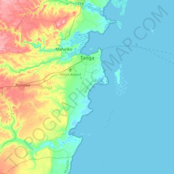
Name: Tanga topographic map, elevation, terrain.
Location: Tanga, Tanga Region, Northern Zone, Tanzania (-5.29507 38.89927 -4.96192 39.15372)
Average elevation: 29 m
Minimum elevation: -2 m
Maximum elevation: 136 m
Thank you for supporting this site ❤️
Make a donation
Make a donation
Other topographic maps
Click on a map to view its topography, its elevation and its terrain.