
Thank you for supporting this site ❤️
Make a donation
Make a donation
Yeongtong-gu topographic map
Click on the map to display elevation.
Thank you for supporting this site ❤️
Make a donation
Make a donation
About this map
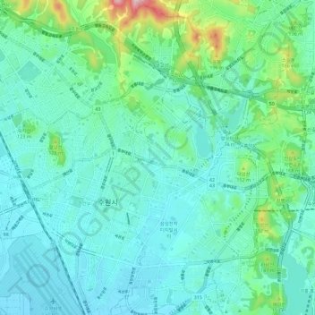
Name: Yeongtong-gu topographic map, elevation, terrain.
Location: Yeongtong-gu, Suwon-si, Gyeonggi, South Korea (37.23119 127.03237 37.32059 127.08987)
Average elevation: 72 m
Minimum elevation: 20 m
Maximum elevation: 304 m
Thank you for supporting this site ❤️
Make a donation
Make a donation
Other topographic maps
Click on a map to view its topography, its elevation and its terrain.