
Machhapuchchhre topographic map
Interactive map
Click on the map to display elevation.
About this map
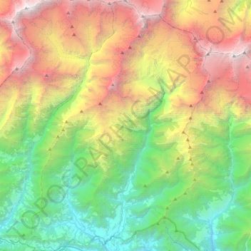
Name: Machhapuchchhre topographic map, elevation, terrain.
Location: Machhapuchchhre, कास्की, Gandaki Pradesh, Nepal (28.28580 83.82755 28.60540 84.08702)
Average elevation: 3,545 m
Minimum elevation: 979 m
Maximum elevation: 8,019 m
Other topographic maps
Click on a map to view its topography, its elevation and its terrain.