
La Sagne-Eglise topographic map
Interactive map
Click on the map to display elevation.
About this map
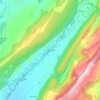
Name: La Sagne-Eglise topographic map, elevation, terrain.
Location: La Sagne-Eglise, La Sagne, Neuchâtel, 2314, Suisse (47.03079 6.79785 47.07079 6.83785)
Average elevation: 1,160 m
Minimum elevation: 1,009 m
Maximum elevation: 1,418 m
Other topographic maps
Click on a map to view its topography, its elevation and its terrain.