
Marmoud topographic map
Interactive map
Click on the map to display elevation.
About this map
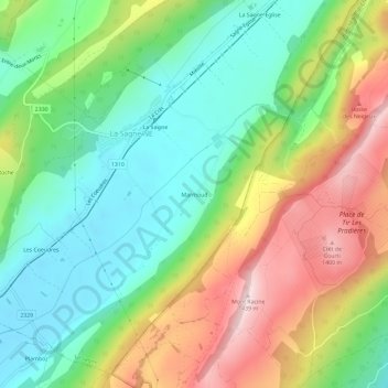
Name: Marmoud topographic map, elevation, terrain.
Location: Marmoud, La Sagne, Neuchâtel, 2314, Suisse (47.01224 6.78798 47.05224 6.82798)
Average elevation: 1,166 m
Minimum elevation: 998 m
Maximum elevation: 1,432 m
Other topographic maps
Click on a map to view its topography, its elevation and its terrain.
La Sagne-Eglise
La Sagne-Eglise, La Sagne, Neuchâtel, 2314, Suisse
Average elevation: 1,160 m