
Thank you for supporting this site ❤️
Make a donation
Make a donation
Copperton topographic map
Click on the map to display elevation.
Thank you for supporting this site ❤️
Make a donation
Make a donation
About this map
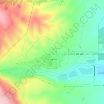
Name: Copperton topographic map, elevation, terrain.
Location: Copperton, Salt Lake County, Utah, United States (40.56229 -112.10629 40.57080 -112.07918)
Average elevation: 1,689 m
Minimum elevation: 1,593 m
Maximum elevation: 1,831 m
Thank you for supporting this site ❤️
Make a donation
Make a donation
Other topographic maps
Click on a map to view its topography, its elevation and its terrain.