
新绛县 topographic map
Interactive map
Click on the map to display elevation.
About this map
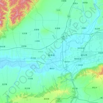
Name: 新绛县 topographic map, elevation, terrain.
Location: 新绛县, 运城市, Xanxim, China (35.45454 111.02959 35.81969 111.34173)
Average elevation: 536 m
Minimum elevation: 380 m
Maximum elevation: 1,549 m
Other topographic maps
Click on a map to view its topography, its elevation and its terrain.