
Dortmund topographic map
Interactive map
Click on the map to display elevation.
About this map
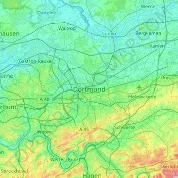
Name: Dortmund topographic map, elevation, terrain.
Average elevation: 112 m
Minimum elevation: 42 m
Maximum elevation: 457 m
Other topographic maps
Click on a map to view its topography, its elevation and its terrain.
Dortmund
Alemania > Renania del Norte-Westfalia > Dortmund
Dortmund, Renania del Norte-Westfalia, Alemania
Average elevation: 108 m