
肥东县 topographic map
Interactive map
Click on the map to display elevation.
About this map
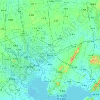
Name: 肥东县 topographic map, elevation, terrain.
Location: 肥东县, Hefei, Anhui, 231600, China (31.56318 117.31597 32.27336 117.87853)
Average elevation: 41 m
Minimum elevation: 3 m
Maximum elevation: 411 m
Other topographic maps
Click on a map to view its topography, its elevation and its terrain.