
Karma topographic map
Interactive map
Click on the map to display elevation.
About this map
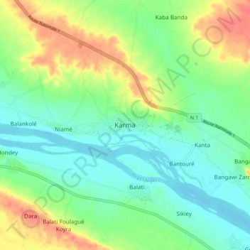
Name: Karma topographic map, elevation, terrain.
Location: Karma, Kollo, Tillabéri, Niger (13.63185 1.77203 13.71185 1.85203)
Average elevation: 205 m
Minimum elevation: 183 m
Maximum elevation: 244 m
Other topographic maps
Click on a map to view its topography, its elevation and its terrain.