
Thank you for supporting this site ❤️
Make a donation
Make a donation
The Hogsback topographic map
Click on the map to display elevation.
Thank you for supporting this site ❤️
Make a donation
Make a donation
About this map
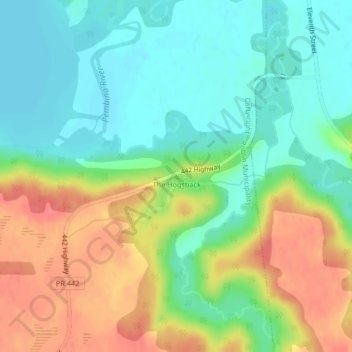
Name: The Hogsback topographic map, elevation, terrain.
Location: The Hogsback, Manitoba, Canada (49.19180 -99.09859 49.19190 -99.09849)
Average elevation: 427 m
Minimum elevation: 402 m
Maximum elevation: 463 m
Thank you for supporting this site ❤️
Make a donation
Make a donation
Other topographic maps
Click on a map to view its topography, its elevation and its terrain.