
Thank you for supporting this site ❤️
Make a donation
Make a donation
Kolwezi topographic map
Click on the map to display elevation.
Thank you for supporting this site ❤️
Make a donation
Make a donation
About this map
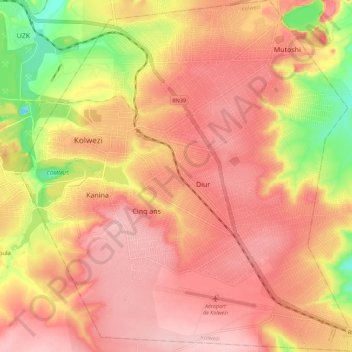
Name: Kolwezi topographic map, elevation, terrain.
Location: Kolwezi, Lualaba, Democratic Republic of the Congo (-10.78291 25.44549 -10.67327 25.55360)
Average elevation: 1,487 m
Minimum elevation: 1,376 m
Maximum elevation: 1,544 m
Thank you for supporting this site ❤️
Make a donation
Make a donation
Other topographic maps
Click on a map to view its topography, its elevation and its terrain.