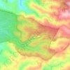
Mount Giles topographic map
Click on the map to display elevation.
About this map
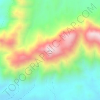
Name: Mount Giles topographic map, elevation, terrain.
Average elevation: 1,040 m
Minimum elevation: 801 m
Maximum elevation: 1,376 m
Other topographic maps
Click on a map to view its topography, its elevation and its terrain.
Sydney
Sydney's topography is characterized by a diverse landscape that seamlessly blends coastal features with inland plateaus. The city is divided into two primary regions: the relatively flat Cumberland Plain to the south and west of Sydney Harbour, and the elevated Hornsby Plateau to the north. The Cumberland…
Average elevation: 53 m
City of Melbourne
Melbourne's topography is characterized by a diverse landscape that transitions from flat coastal plains to rolling hills and mountainous regions. The city is situated at the northern end of Port Phillip Bay, where the terrain is predominantly flat, facilitating urban development. As one moves eastward, the…
Average elevation: 18 m
Victoria
Victoria, Australia, exhibits a remarkably varied topography shaped by the Great Dividing Range, which forms a west-to-east spine across the state. In the northeast, the Victorian Alps rise to the state’s highest point, Mount Bogong at 1,986 meters, amid deep valleys and snow-capped ridges, while westward,…
Average elevation: 179 m
New South Wales
New South Wales (NSW), located on Australia's eastern seaboard, boasts a diverse topography that significantly influences its landscapes and ecosystems. The state's eastern edge is dominated by a narrow coastal plain, featuring regions such as the Illawarra and Shoalhaven near Nowra, characterized by rolling…
Average elevation: 154 m
Western Australia
Because the only mountain-building since then has been of the Stirling Range with the rifting from Antarctica, the land is extremely eroded and ancient, with no part of the state above 1,245 metres (4,085 ft) AHD (at Mount Meharry in the Hamersley Range of the Pilbara region). Most of the state is a low…
Average elevation: 194 m
Melbourne
Melbourne is also prone to isolated convective showers forming when a cold pool crosses the state, especially if there is considerable daytime heating. These showers are often heavy and can include hail, squalls, and significant drops in temperature, but they often pass through very quickly with a rapid…
Average elevation: 185 m
Queensland
Queensland's topography is characterized by a diverse landscape that includes coastal plains, mountain ranges, plateaus, and expansive inland areas. The Great Dividing Range runs parallel to the state's eastern coast, forming a series of mountain ranges, plateaus, and upland areas. This range influences the…
Average elevation: 122 m
Tasmania
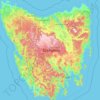
The most mountainous region is the Central Highlands area, which covers most of the central western parts of the state. The Midlands located in the central east, is fairly flat, and is predominantly used for agriculture, although farming activity is scattered throughout the state. Tasmania's tallest mountain…
Average elevation: 220 m
New South Wales
New South Wales (NSW), located on Australia's eastern seaboard, boasts a diverse topography that significantly influences its landscapes and ecosystems. The state's eastern edge is dominated by a narrow coastal plain, featuring regions such as the Illawarra and Shoalhaven near Nowra, characterized by rolling…
Average elevation: 154 m
Melbourne
Melbourne is also prone to isolated convective showers forming when a cold pool crosses the state, especially if there is considerable daytime heating. These showers are often heavy and can include hail, squalls, and significant drops in temperature, but they often pass through very quickly with a rapid…
Average elevation: 185 m
Great Dividing Range
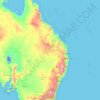
The Great Dividing Range, also known as the East Australian Cordillera or the Eastern Highlands, is a cordillera system in eastern Australia consisting of an expansive collection of mountain ranges, plateaus and rolling hills, that runs roughly parallel to the east coast of Australia and forms the…
Average elevation: 117 m

City of Brisbane
Brisbane's topography is characterized by a series of hills and ranges that define its landscape. The city is situated on a low-lying floodplain, with the Brisbane River meandering through its heart, creating a winding course with many steep curves from the southwest to its mouth at Moreton Bay in the east.…
Average elevation: 71 m
Orange
Orange is a city in the Central Tablelands region of New South Wales, Australia. It is 254 km (158 mi) west of the state capital, Sydney [206 km (128 mi) on a great circle], at an altitude of 862 metres (2,828 ft). Orange had an estimated urban population of 40,493 as of June 2018 making the city a significant…
Average elevation: 852 m
Grampians National Park
Mount William is known within the gliding community for the "Grampians Wave", a weather phenomenon that sometimes enables glider pilots to reach extreme altitudes of the order of 28,000 ft (8,500 m). This predominantly occurs during the months of May, June, September and October when strong westerly winds flow…
Average elevation: 262 m


Adaminaby
Another site 20 km to the north (Yaouk, since 1969) records significantly greater rainfall due to its higher elevation and proximity to the dividing range. This site is most representative of the areas situated on and around Lake Eucumbene. Rainfall total and pattern here approach those of Khancoban and very…
Average elevation: 1,174 m



Adelaide
Australia > South Australia > Adelaide City Council
South Australia was officially established as a British Province in England in February 1836. The first governor proclaimed the commencement of colonial government in South Australia on 28 December 1836, near The Old Gum Tree in what is now the suburb of Glenelg North. The event is commemorated in South…
Average elevation: 146 m

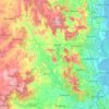
Brisbane River
The RAAF also perform a practice session in the days preceding the event, serving as an opportunity to both practice beforehand and also promote Riverfire. One of the most popular RAAF aircraft to perform at Riverfire was the F-111 which was known for performing a 'dump-and-burn' above the city. The final…
Average elevation: 235 m

Tasmania
The most mountainous region is the Central Highlands area, which covers most of the central western parts of the state. The Midlands located in the central east, is fairly flat, and is predominantly used for agriculture, although farming activity is scattered throughout the state. Tasmania's tallest mountain…
Average elevation: 6 m


Sydney
Sydney's topography is characterized by a diverse landscape that seamlessly blends coastal features with inland plateaus. The city is divided into two primary regions: the relatively flat Cumberland Plain to the south and west of Sydney Harbour, and the elevated Hornsby Plateau to the north. The Cumberland…
Average elevation: 53 m


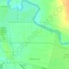


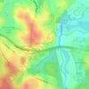


Mount Coot-tha
Australia > Queensland > City of Brisbane
It is often claimed that Mount Coot-tha is the "highest point in Brisbane", but, as the elevations above show, the peak known as Mount Coot-tha is not even the highest peak of the mountain as a whole with both Constitution Hill and The Summit being higher. However, Mount Coot-tha has a lookout with unobscured…
Average elevation: 88 m








Castlemaine
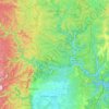
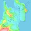
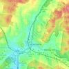
The Castlemaine goldfields' legendary prosperity raised expectations of Castlemaine becoming Victoria's second city. That is reflected in imposing buildings erected in the town's first few years. Though the rich alluvial diggings were largely exhausted within 15–20 years causing the town's population to…
Average elevation: 319 m
Yass
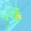
Yass is located 280 km south-west of Sydney, on the Hume Highway. The Yass River, which is a tributary of the Murrumbidgee River, flows through the town. Yass is 59 km from Canberra; lying at an elevation of 505 m AMSL.
Average elevation: 533 m

Fitzroy
Australia > Victoria > Melbourne
Fitzroy's topography is flat. It is laid out in grid plan and is characterised by a fairly tightly spaced rectangular grid of medium-sized streets, with many of its narrow streets and back lanes facilitating only one-way traffic. Its built form is a legacy of its early history when a mixture of land uses was…
Average elevation: 35 m