
Workum topographic map
Interactive map
Click on the map to display elevation.
About this map
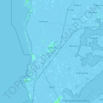
Name: Workum topographic map, elevation, terrain.
Location: Workum, Súdwest-Fryslân, Frise, Pays-Bas (52.93484 5.29796 53.01255 5.48009)
Average elevation: -1 m
Minimum elevation: -6 m
Maximum elevation: 5 m
Other topographic maps
Click on a map to view its topography, its elevation and its terrain.
Neare Galle
Neare Galle, Grou, Leeuwarden, Frise, Pays-Bas, 9001 ZS, Pays-Bas
Average elevation: 0 m
Diepe Sloot
Diepe Sloot, Akkrum, Heerenveen, Frise, Pays-Bas, 8491PH, Pays-Bas
Average elevation: 0 m
Wide Galle
Wide Galle, Grou, Leeuwarden, Frise, Pays-Bas, 9001AA, Pays-Bas
Average elevation: 0 m
Camping
Pays-Bas > Frise > De Fryske Marren
Camping, De Fryske Marren, Frise, Pays-Bas, 8493KN, Pays-Bas
Average elevation: -1 m
West-Terschelling
Pays-Bas > Frise > Terschelling
West-Terschelling, Terschelling, Frise, Pays-Bas
Average elevation: 0 m