
Thank you for supporting this site ❤️
Make a donation
Make a donation
Low Gap topographic map
Click on the map to display elevation.
Thank you for supporting this site ❤️
Make a donation
Make a donation
About this map
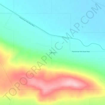
Name: Low Gap topographic map, elevation, terrain.
Location: Low Gap, Grant County, Washington, United States (46.96597 -119.81171 47.00597 -119.77171)
Average elevation: 418 m
Minimum elevation: 356 m
Maximum elevation: 538 m
Thank you for supporting this site ❤️
Make a donation
Make a donation
Other topographic maps
Click on a map to view its topography, its elevation and its terrain.