
Keiskammahoek topographic map
Interactive map
Click on the map to display elevation.
About this map
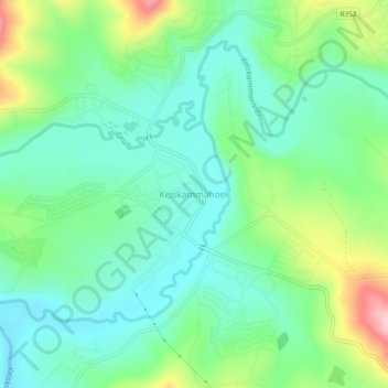
Name: Keiskammahoek topographic map, elevation, terrain.
Average elevation: 669 m
Minimum elevation: 611 m
Maximum elevation: 807 m
Other topographic maps
Click on a map to view its topography, its elevation and its terrain.
Kubusi River
South Africa > Eastern Cape > Amathole District Municipality > Amahlathi Local Municipality
Average elevation: 799 m